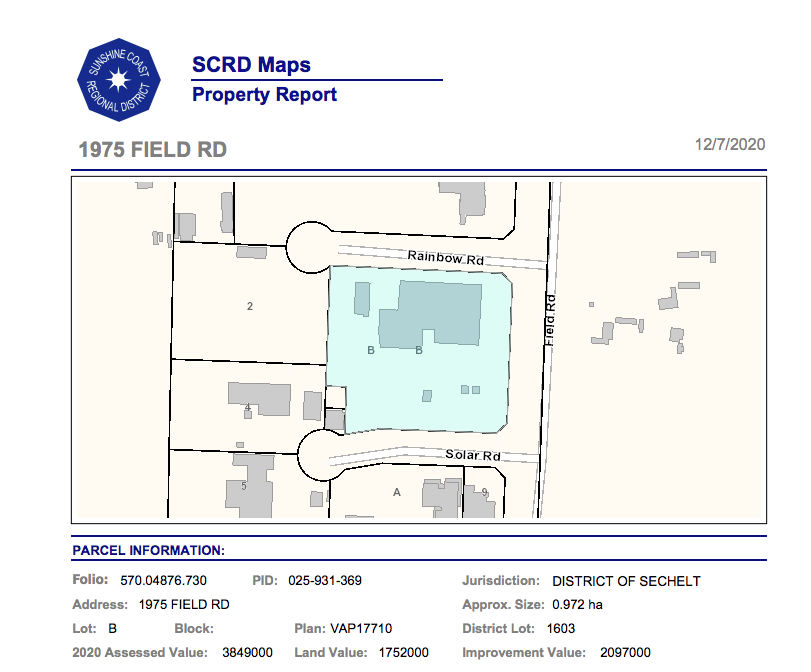
Public information such as lot size, value and applicable zoning bylaws is now available through a new property reporting tool released by the Sunshine Coast Regional District (SCRD).
The Property Report tool can be accessed through SCRD’s mapping page and through an address search generates a report that includes lot size, jurisdiction, land and assessed value, rural area Official Community Plan designation, water service area, fire protection area, solid waste service area and development permit area if applicable.
“The launch of the property reporting tool will give our citizens easy access to information about their Sunshine Coast property,” said SCRD’s Geographical Information Systems (GIS) administrator Cheryl Trent.
She told Coast Reporter the tool was developed to make it easier for the public to get answers to the most commonly asked questions about properties. “With the global pandemic making it necessary for everyone to reduce person-to-person interactions, releasing a tool like this was given top priority,” she said.
SCRD staff and the public have access to property information for the 381,000 hectares comprising the SCRD through its GIS mapping division. It also maintains a civic addressing system for the rural areas and municipalities, Sechelt Indian Government District and the islands.
“The SCRD is excited to provide current property information to the community in a format accessible by all devices,” said Trent, adding: “The long-term plan is to continue to develop more tools that enhance the use of our web services for residents and businesses on the Sunshine Coast.”
Access to the downloadable PDF reports can be found at www.scrd.ca/myscrdmaps


