Thunder and lightning rolled over the Sunshine Coast late Monday night and into the morning.
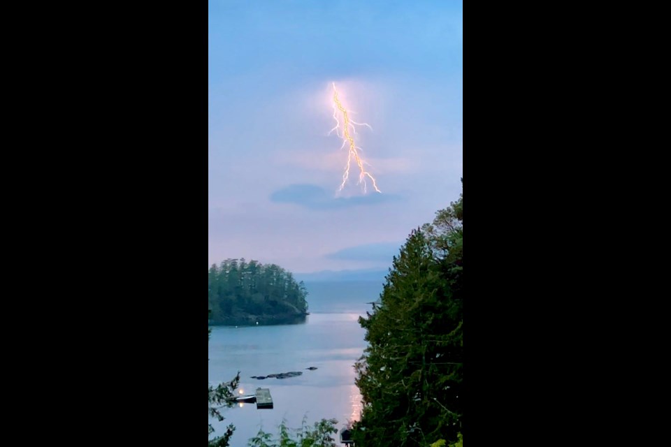
Just after 8:15 p.m., photographer John Preissl captured the flashes of light from his home in Secret Cove.
The storm featured both sheet and fork lightning over the Salish Sea and hammered qathet and the mountains above Sechelt until 5 a.m., Preissl told Coast Reporter in an email. It was the biggest lightning storm he’s ever seen. His lightning tracker app highlighted activity up and down Sechelt Inlet.
“Hopefully the rain keeps coming and no new wildfires,” Preissl added. Lightning sparked five wildfires on Vancouver Island Monday afternoon.
On the Coast, two small wildfires were reported Tuesday morning. The first was discovered north of Clowhom Lake just after 8:45 a.m. and estimated to be 0.009 hectares (approximately 90 square metres). A second fire on Salmon Inlet was reported at 9:26 a.m. on Tuesday as approximately 90 square metres. The suspected cause for both fires is listed as "lightning / natural."
Environment Canada forecasts a few thunderstorms to continue on Tuesday morning, before a mainly cloudy day. There will be a 60 per cent chance of showers in Gibsons and Sechelt as temperatures are around 19C. Thunderstorms and showers may continue Tuesday evening and overnight, with 20 kilometre/hour northeast winds after midnight.
Wednesday is forecast to have 20 km/h winds and a mix of sun and cloud before showers return on Thursday.
The long weekend is anticipated to see a mix of sun and clouds.
Keep an eye on the forecast and local weather information with Weatherhood.


