The Sunshine Coast survived this past weekend’s atmospheric river, largely unscathed, especially when compared to some areas on the Lower Mainland and Vancouver Island.
According to the Sunshine Coast Regional District and the RCMP, there were no incidents to report related to the storm. Last Friday, Environment Canada issued a special weather warning for much of Southwest BC, including the Sunshine Coast, which was expected to receive more than 70mm of rain on Saturday, Oct. 19.
Trees downed due to the storm did knock out power to several locations Friday and Saturday, including in and around Roberts Creek, Sechelt, Secret Cove and Halfmoon Bay.
Sunshine Coast photographer Ken McCann braved the weather this weekend to get the dramatic photos of the Ocean Betty included in the gallery above. McCann followed the tug boat from Sechelt to Jack Road to get the photos he calls, “shots of a lifetime.”
Also braving the elements this past weekend was Roberts Creek resident Anna Wright, who captured before and after photos of both Gough Creek and Clack Creek on Day Road (also included in the photo gallery).
Wright described the photos of the fast-running water as an example of, “Mother Nature reclaiming dominion of her Day Road creeks.” White gives credit to the culverts for helping to stablize the roadbed, but notes Clack Creek did break through all barriers and washed away the form work.
Bill Krause, manager of the Chapman Creek Hatchery, said he didn’t anticipate many negative effects from the high water and heavy turbidity, which took place all day Saturday, but cleared up by Sunday. He added the creek level peaked at about 10 a.m., Saturday.
“Chapman creek was high, but nothing like 2021. We were lucky that there was no snowpack on the mountains this time around,” he told Coast Reporter in an email. “There could be some spawning areas that were affected from the high water and flows, but that's unknown at this point.”
Shirley Samples, president of the Sunshine Coast Streamkeepers Society, said the group is monitoring Roberts Creek and Malcolm Creek spawners and on Saturday and Sunday, both creeks were running extremely fast and both were dark with tannin.
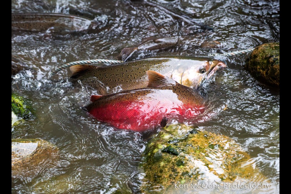
“The damage would happen if the water was so powerful it moved the rocks and gravel, thus destroying the redds [nests]. This is a concern, as we had the highest number of pink returns we have ever counted since 2018,” Samples told Coast Reporter in an email. She said between Sept. 3 and Oct. 15, there were 2,990 salmon counted, mostly pink spawners.
She adds chum and coho salmon are arriving now and the benefit of such a rain storm is, the higher water helps the fish enter the creeks. Samples notes the group will continue its weekly counts, so members will be able to see how many more fish entered the creek and were able to find places to hold safely and survive.
East Porpoise Bay resident Louis Legal shared their weekend rainfall with Coast Reporter, measuring 70.8mm on Saturday, 17mm on Sunday and 15.6 overnight to Monday morning for a total rainfall of 100.4mm.
Gibsons' Gower Point Road weather station reported 72.8mm of precipitation on Friday and 31.8mm Saturday, according to Environment Canada.
Other areas of Greater Vancouver and the Lower Mainland hit the hardest with heavy rain causing flooding included, Coquitlam: 161-228mm, West Vancouver: 177mm, Vancouver Harbour: 150mm, Pitt Meadows: 144mm, Abbotsford: 125mm, Agassiz: 124mm, White Rock: 114mm Chilliwack: 113mm, YVR: 106mm, Tofino: 213mm, Squamish: 108mm and Kennedy Lake on Vancouver Island: 301mm.
Meanwhile, Environment Canada has introduced a new program to help predict and alert residents about coastal flooding.
With this new program, meteorologists will be able to issue coastal flooding forecasts in all coverage zones using new modelling techniques and the Coastal Flood Risk Index. The index evaluates the likelihood and expected impact of an event to determine the level of risk it poses. Using this system, meteorologists can assign an event a risk rating ranging from low to extreme.
To communicate the risk of coastal flooding, Environment Canada meteorologists will issue forecasts using Coastal Flooding Risk Outlook maps. This information will notify Canadians early of high-impact coastal flooding events and enable informed decision-making.
These maps will also inform public authorities and emergency management organizations of the potential risk for coastal flooding events. Receiving this information early will help them plan and respond to high-impact events.
Canadians will be able to see these maps in the media or shared on social media by regional forecast centres.
Words missing in article? Your adblocker might be preventing hyperlinked text from appearing.


