Gibsons council passed first reading of an Official Community Plan amendment to update Development Permit Area (DPA) No. 2 (Environmentally Sensitive Areas) at its July 9 council meeting.
The land within DPA 2 (intended to protect the “natural environment, its ecosystems, features, and biological diversity”) often requires a professional report before it can be altered, subdivided or a building permit issued.
Environmentally sensitive areas are “rich in biodiversity and serve as crucial habitats for endangered species, exhibiting unique or exceptional characteristics within the local or regional context,” says the DPA2 update.
The current DPA2 was created in 2005, Aubrey Butcher, a biologist and the interim project manager from Diamond Head Consulting, told council members at a June 18 committee of the whole meeting. “As time progresses, there have been changes to pressures and threats that put these ecosystems and sensitive areas at risk,” he shared.
This update comes as more current data is available, as development proposals have increased within the town and best management practices have changed, a staff report said. The DPA identifies areas not previously protected and introduces restoration guidelines.
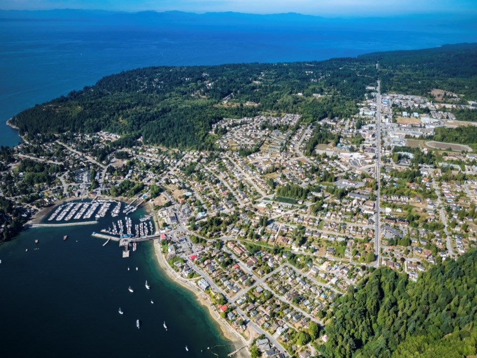
With natural areas covering about a quarter of Gibsons (though disturbed by development and industry), the region has mixed forests (no old-growth), many small and ephemeral swamps and wetlands and 14.6 km of watercourses.
Few species at risk have been confirmed in Gibsons, but remaining natural areas are “remnants of ecosystems at risk,” said the report.
The update proposes paring down five DPA categories to three: freshwater ecosystems and riparian areas; marine shoreline and eelgrass beds; and terrestrial ecosystems.
The update proposes expanding the definition of stream to include all watercourses protected under provincial regulations, with the DPA extending 30 metres from the top of a freshwater or riparian bank.
For the marine shoreline and eelgrass beds, the DPA extends 50 metres inland, but in some areas is shortened to the edge of a major roadway (notably Marine Drive). It includes all areas below the high tide line (the town holds a recreational water lease along its shoreline so this falls within its jurisdiction).
Other key recommendations of the report include identifying the ephemeral wetlands so they may be protected, even in dry seasons; confirming fishbearing watercourses and coordinating with the SCRD on a “regional wildlife habitat connectivity network.”
The update also firms up the DPA process: what’s included and excluded and clarifying what a qualified environmental professional is. “We also created a checklist and updated DPA guidelines to help guide developers through the process,” said Butcher. While the list is extensive, guidelines fall into four broad categories, he said. These include moving the development away from environmentally sensitive areas and reducing building footprints, designing buildings to minimize impact (eg. tree and vegetation retention), protecting and restoring these areas (eg. covenants and land dedications) and minimizing impact during construction.
At the June 18 meeting, Coun. Annemarie De Andrade said she’s been waiting six years for this report. “I’m excited. I love all the pieces – the details, the guideline and the checklist.”
The report has been referred to the Sunshine Coast Regional District, District of Sechelt, Sḵwx̱wú7mesh Úxwumixw (Squamish Nation), School District 46, Vancouver Coastal Health and Sunshine Coast Conservation Association.


