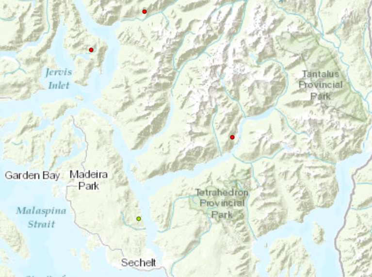
The two wildfires nearest to Sechelt have received updated information.
According to BC Wildfire Service (BCWS), visibility in the air has improved this week, which has allowed for more precise flyovers that have provided more accurate information on the fires.
Fire V53097 near Vancouver River was increased to a size of four hectares. The fire is still being monitored closely and is still in rugged, steep terrain that is unsafe for crews to access.
BCWS explained Wednesday that the initial fire size online is an estimation based on data, and that, “when they have those windows of good visibility, they get out there and take a closer look. They were able to do that last night and get a new track on it, and that's where that size increase has come from.”
Fire V53027 near Clowhom Lake also increased, to five hectares. BCWS said this fire is also surrounded by steep terrain with no access, and that there are "significant cliffs" within the fire perimeter. Crews noted that the fire was moving up-slope, away from nearby communities.
BCWS said that they are considering if they can get heavy equipment into the Clowhom Lake region to see if there are any workable objectives or safe areas they can take action from.
Jordan Copp is the Coast Reporter’s civic and Indigenous affairs reporter. This reporting beat is made possible by the Local Journalism Initiative.


