A freshly restored way of seeing the geography of the shíshálh Nation’s swiya (homeland) is emerging from three years of research and collaboration.
Through the leadership of Jessica Silvey, an Indigenous faculty advisor at Capilano University, a newly created map was released on May 18 that situates traditional shíshálh knowledge, village sites and place names in the she shashishalhem language.
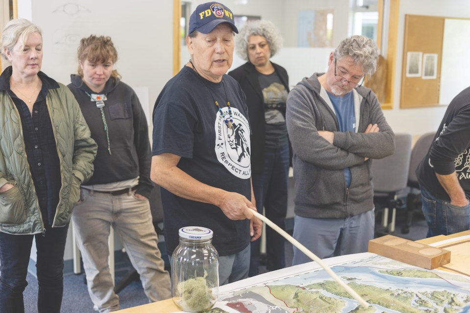
Silvey led the project alongside her husband, Robert Joe, the Elder in Residence at Capilano University’s Sechelt k̲álax̲-ay campus, and students in the school’s Pathways to Higher Learning program.
The group began in 2022 by compiling archival materials gathered from records of Sunshine Coast historian Lester Peterson. Peterson is the author of the book The Story of the Sechelt Nation, published four years after the shíshálh achieved self-government in 1986.
Silvey and her team reclaimed a campus hallway that had formerly been adorned with a boilerplate account of residential schools. Bit by bit, an anecdotal chronology of nation history from 1800 took shape. Cultural milestones (like canoe races instituted in 1987) are posted alongside political victories like the 2023 election of yalxwemult (Lenora Joe) as the first shíshálh woman to be elected lhe hiwus (chief). Space is allocated for future events through 2040.
“We’re going to have generations and generations of students coming through here,” said Silvey, “and I always want them to have a feeling of connection.”
Using oral recollections, family histories and other sources, traditional place names are being re-applied to Sunshine Coast geography. Supplementing the original nomenclature for Sechelt (ch’atelich), significant locales in Sechelt Inlet and its arms have been identified — like klye-kwim, where shíshálh people were given the knowledge of how to catch and cure herring and the art of cooking clams.
A limited-release print edition of the map was distributed to attendees of Mapping swiya, a series of dialogues held on May 18 as part of the Sechelt Arts Festival. The document shows traditional place names as a step toward what was masked or erased by colonial policies.
“The [festival-related] process itself is really connected to our work in reconciliation and The Gathering Place,” said Sadira Rodrigues, curator and director of the Sunshine Coast Arts Council.
The Gathering Place is a downtown Sechelt storefront operated in conjunction with Red Cedar Woman Weaving that provides a nexus for Indigenous and settler encounters.
“The Mapping swiya gathering was very much meant to be a service to the community that’s been meeting, but now we want to start to story-tell it,” explained Rodrigues. “Now we’re going to do more of the public-facing program.”
The mapping project enlisted the cooperation of Vancouver-based designers Jean Chisholm, Marcia Higuchi, and Laura Kozak. Kozak, who works at Emily Carr University, was one of several presenters during the day-long workshop about Indigenous approaches to mapping.
Kozak quoted the Sto:lo writer and activist Lee Maracle, who asked what stories the land is telling us. “She asked that not in a way that was abstract or metaphorical but in a very direct way,” Kozak said. “What are you going to do with the stories that you’re hearing and interpreting right now?”
The Mapping swiya project is visible to visitors on the Capilano University campus in Sechelt. Its development is designed to be iterative, explained Silvey, transforming over time.
An expanding list of festival events is available at secheltartsfestival.com.


