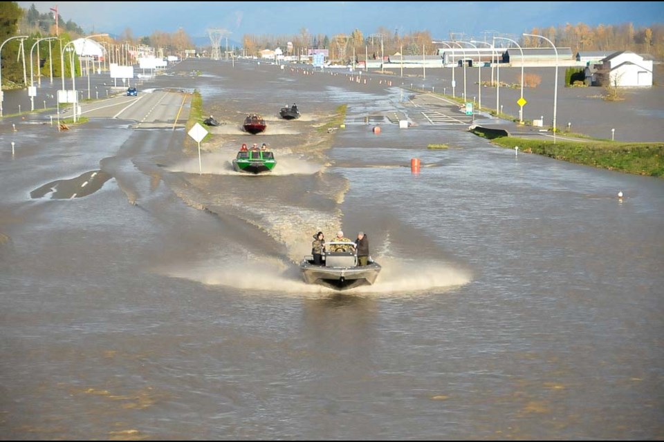
The record floods that washed out British Columbia’s highway system, killed five people in landslides and flooded several communities was made two to four times more likely because of human-caused climate change, a new study has found.
The research, the latest in an emerging science known as “rapid attribution studies,” has not been peer-reviewed. It brought together a leading group of 14 climate researchers to gauge how climate change influenced the magnitude of the atmospheric river weather event, how much rain it dropped and the rivers that later flooded.
From the air, the kind of atmospheric river that made landfall in B.C. last November was made at least 60 per cent more likely due to human influence on the climate. By the end of the century, the report notes such rainfall events are expected to become twice as frequent.
“Those return periods are going to continually get shorter as climate change proceeds,” said co-author Faron Anslow, a climate scientist at the University of Victoria's Pacific Climate Impacts Consortium (PCIC).
“What we see right now is changing under our feet.”
Atmospheric rivers are made up of long ribbons of water vapour, which regularly funnel warm, subtropical air from lower latitudes to B.C.’s coast in the winter. Moving with the weather, they stretch thousands of kilometres and carry moisture “equivalent to the average flow of water at the mouth of the Mississippi River," according to the U.S. National Oceanic and Atmospheric Administration.
Past studies have found atmospheric rivers are responsible for 90 per cent of extreme rainfall in coastal B.C. While common in places like California, over the last several decades, they have increasingly made landfall in B.C. and Alaska.
In the case of November’s atmospheric river, the rainfall was the main driver of the flooding that rocked many B.C. communities, said Elizaveta Malinina, one of the report's authors and a research scientist at Environment Climate Change Canada’s Centre for Climate Modelling and Analysis.
Under current climatic conditions, such a storm could return every 10 years. That drops to every eight years with 1.5 C of warming, and once every five years if global mean temperatures climb 3 C above pre-industrial levels, something Malinina says could happen by the 2080s.
But the atmospheric river also raised temperatures across the region, melting snowpack and swelling rivers to levels usually only witnessed every 50 to 100 years.
“At the really fine-scale, it was really unprecedented,” said Anslow, who last summer co-authored a rapid attribution study linking the Western North America heat dome to climate change.
The flooding has led to an estimated $450 million in insured damage, making it the most expensive natural disaster in B.C.’s history, according to the Insurance Bureau of Canada. The real financial toll, however, is thought to be much higher, as many flooded residents did not have flood insurance. The province, meanwhile, is expected to be on the hook for billions of dollars more.
Consider the widespread destruction seen in Princeton, the evacuation of the entire town of Merritt, or the flooding of roughly 1,000 homes in the Sumas Prairie region of Abbotsford — each community has its own unique geography and risks, said Malinina.
“Basically, this precipitation over two days was the main driver of the flood,” she said. “But risks for different rivers varies a lot.”
In the Coldwater River near Merritt, for example, the chances of a 100-year flood have spiked over 50 per cent since 1950, while in the Stave River, that risk has climbed only 13 per cent.
As B.C. looks to rebuild, both Anslow and Malinina say those kinds of local differences matter.
“We had to do this study relatively quickly while it’s still important,” said Malinina. “...right now there are workers rebuilding.”
“Use these numbers to plan for the future.”


