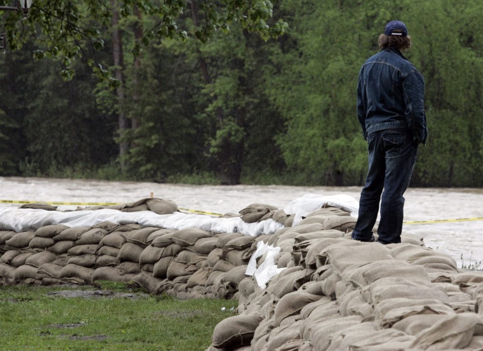
A series of atmospheric rivers has been moving across British Columbia's north and central coasts and spreading into the Interior, bringing heavy rain.
The River Forecast Centre is maintaining high-stream flow advisories and several flood watches throughout the province, while a higher-level flood warning has been downgraded for the Telkwa River in northwestern B.C.
The centre says the river east of Terrace peaked Tuesday, registering flow levels between a 20- and 50-year return period, while most other coastal rivers had been peaking at levels typically seen every one to five years.
The forecaster says moderate to heavy rain had started spreading across the Interior, where flood watches are in effect near B.C.'s boundary with Alberta.
The bulletin covers the headwaters of the Clearwater River, the North Thompson River above the Blue River, and the Canoe River at the northern end of Kinbasket Lake.
Lower-level streamflow advisories cover the Cariboo region, including headwaters of the Quesnel River, as well as the rest of the North Thompson and the South Thompson, Upper Fraser and Upper Columbia rivers and their surrounding areas.
Wednesday's bulletin says waterways could see rapid increases in flows, and heavy rain could worsen runoff from areas scorched by wildfire.
Environment Canada has issued a series of wind warnings and special weather statements throughout much of the province.
The weather office says many areas in the southern Interior and southeast were expected to see strong winds and heavy downpours through Wednesday night.
Another bulletin says an intense low pressure system — the remnants of Typhoon Pulasan — would bring strong winds to coastal areas on Thursday.
Winds are expected to reach speeds of 90 km/h with gusts up to 120 km/h on exposed sections of northern Vancouver Island, Haida Gwaii and the central coast.
This report by The Canadian Press was first published Sept. 25, 2024.
The Canadian Press


